Summer’s passed and the Alt-Antiquarian shares his holiday snaps…

 Sometimes one experiences an object lesson in how closely related the antiquarian instinct and psychogeographic sensitivity can be, in reality as well as in the observer. Still, it can be a surprise…
It’s always a pleasure to discover such convergence where one might not immediately expect them. Take Cleethorpes, largely a modern (19th century) if not especially contemporary tourist town, in the rather flat landscape of coastal Lincolnshire. If one is really poking around for magical references in the good old earth mysteries tradition, one might see significance in the town being a coalescence of three villages, Itterby, Oole and Thrunscoe, or in its position on the Greenwich Meridian. Oh, and it’s twinned with Königswinter (King’s Winter) in the Rhineland, where on Drachenfels mountain there is a cave wherein Siegfried’s dragon lurked.
But more interesting is the old town, Old Clee, with a late Saxon tower to its Grade 1 listed church a mile or so inland; and on its fringes there is a curious settlement, a kind of shanty town called the Humberston Fitties, an ex-barracks area which after World War One became a ‘squatted’ holiday resort by working-class families seeking fresh air and respite from the polluted industrial towns inland. Over time their campsites became ‘developed’ into homemade shacks, repurposed buses and train carriages. Land ownership passed to the local authority in 1938, who leased plots. Areas like this became known as the Fitties (meaning ‘salt marsh’) and are a marker of a kind of 1920s working class pioneer spirit. Naturally, it has now lost that character, and prices are high, though some houses still maintain their shanty character.
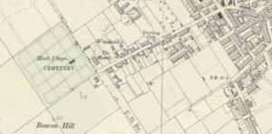
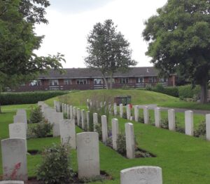
But it’s the walk from Old Clee to the sea that grabs the alt-antiquarian. Naturally in such a landscape one has to check out a thoroughfare called Beacon Avenue, and if you have an OS map you’ll find that the beacon site is a prehistoric burial mound, not far above sea level but high enough. And this is where a psychogeographical element creeps in, because the local authority has made the mound the centre of a cemetery, thus setting up a thematic echo in the landscape between the Bronze Age and now.
The mound in the cemetery (Ingrid Burney)
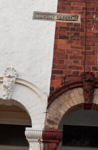
At the side of the cemetery is a track and takes you towards town and sea along a pretty straight route along Mill Road. A little way down on the left, a driveway entrance to a large house called The Mount is flanked by two large boulders that can’t fail to put one in mind of markstones, surely a coincidence, but the antiquarian psychogeography is just getting warmed up now. Further down you walk by a row of houses called Dowsing Terrace, and keep going down to cross over a road to a junction of Cambridge Road and Knoll Road – and it’s here that you encounter Cleethorpes’ Zone of Liminalities…
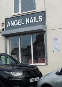
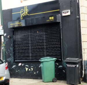
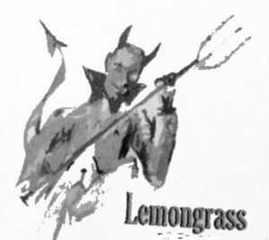
There’s a knot of eight shops here – at least there was when I visited in 2020 (sorry, these aren’t recent holiday snaps). Among them was the Globe Café and shop, selling weird goods like jams with a demonic logo (and good coffee), and then this is followed by an extraordinary collection of traders alluding to liminal entities… First you come to The Magic Fairies boutique, then on the other side of the road is Angel Nails, and close by a ‘wine kitchen’ called Folk, and a couple of shops down Littlepeopletrading.com…. What is going on here, I wondered, is this a new take on the idea of the Mystical East, or is it a conspiracy!
Globe Cafe
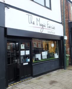 The Magic Fairies
Angel Nails
Folk
Little People Trading Co.
Alas, as Knoll Road turns a bend and aims again towards the seafront, this weird zone releases its nomenclatural hold and Cleethorpes returns to its more everyday character… But still I wonder if I should have gone back there after midnight.
Published in NE173 (Sept. 2023), pp11-13